
CLOUD GEOGRAPHICAL OPERATING SYSTEM
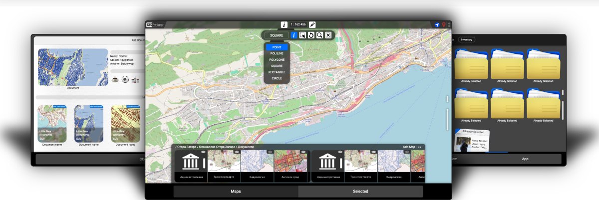

SUPPORT FOR ALL DEVICES
NEXGIS is a geographical information system
to manage and augment data and analytics through integrated applications
with an innovative interface.


FUNDAMENTS

FILE SYSTEM
HIERARCHICAL USER AND DOCUMENT STRUCTURE.

GIS EXPLORER
GRAPHIC EDITOR FOR WORK, CREATION AND MAP ANALYSIS

DOCUMENTS
CONTAINER TYPE STORAGE TEXT, PICTURES AND LINKS TO DOCUMENTS AND MAPS

MULTITASKING
WORKING WITH SEVERAL APPLICATIONS AND EXCHANGING INFORMATION BETWEEN THEM.
GIS Explorer Video

NEXGIS is a solution that meets the requirements of Bulgarian legislation, while at the same time it is
open
source architecture that allows for easy integration.
NEXGIS WEB has a toolkit for creating and maintaining geographic databases, designing, geodetic services, analysis, creation of geographical maps and others.
Covers the basic requirements for the operation of:
State administrations Municipal administrations Surveying companies and Cadastral Offices Companies using geographic and cadastral information in their daily work Planning, design and construction in the field of geodesy Analysis, planning and design for territorial and settlement planning Road construction and transport Telecommunications companies Utility companies Environment and natural resources Agriculture Healthcare etc.
NEXGIS WEB has a toolkit for creating and maintaining geographic databases, designing, geodetic services, analysis, creation of geographical maps and others.
Covers the basic requirements for the operation of:
State administrations Municipal administrations Surveying companies and Cadastral Offices Companies using geographic and cadastral information in their daily work Planning, design and construction in the field of geodesy Analysis, planning and design for territorial and settlement planning Road construction and transport Telecommunications companies Utility companies Environment and natural resources Agriculture Healthcare etc.
Copyright © 2022 NEXGIS Technologies Ltd.
All Rights Reserved.
All Rights Reserved.